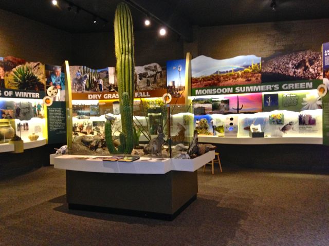
POSTCARDS
Stephanie is one of those persons who can fit a lot of words onto a standard size postcard -- usually by writing sideways, around corners, and even upside down if she can find some extra space. Most of these go to family and friends. But some of them -- those which document our RV adventures -- find their way onto this portion of our website.
The Road to Great Falls
June 4-14, 2014
Our Florence house is undergoing some extensive remodeling. Not the house itself, but the driveway and front walk are being torn out and replaced. But this isn’t just an ordinary, dump-the concrete-and leave project. Our newly combined drive and walkway are going to be “stamped”. First, the old concrete and stepping stone walk were torn out. Next, rebar was laced over the area. Then one morning, precisely at 8am, the concrete truck arrived to pour about 1/3rd of the project. Once poured, a dark brown/black mixture was carefully applied in a swirling design to a portion of the new concrete. When this had dried a bit,the stamping began. The “stamps” resemble large rubber mats - smooth on one side, but with a three dimensional swirl on the other. They are placed on the still gooey concrete, and literally stamped on - both with feet and a heavy mallet-like tool. When the surface of one mat is finished, another is placed next to it, and so on over the whole driveway. Each mat, and there are at least a half dozen in the set, is turned 90 degrees after use, so there is no repeat pattern. Finally, a few days after the concrete work is finished, a finishing coat will be added to bring out the color, and the whole thing sealed.
This is obviously a time consuming process, as the concrete must be exactly the right consistency for each step. The “down” side, for the property owner, is that you cannot use your driveway or walkway for a minimum of 3 weeks after the concrete is poured; and our coach is declared off-limits for a month. Our neighbors have been most accommodating, letting us park both coach and car in their driveways. But we had an additional solution - let’s take an RV trip!
Our itinerary had already been planned. First stop, Yakima, Washington to see our grandson graduate from high school. La Salle is a small Catholic school, with the proud reputation of 100% college acceptance for its graduates. The evening before the graduation ceremony, we attended the Baccalaureate service. The actual graduation was held the following morning outside on the green at the school. How great seeing our young grandson growing up and starting out. Proud grandparents were we…
From Yakima, we headed east toward Great Falls, Montana. We have 6 days to wander the Palouse country of Washington and Idaho, cross the mountains of the Selway-Bitterroot Wilderness at Lolo Pass, and revisit favorite spots along the way. This is Lewis and Clark country, and we’ll follow much of their trail.
From Yakima, we took I-82 to the Tri-Cities, Richland, Kennewick and Pasco. Crossing the Columbia River, I could see the mouth of the Yakima River. So could a dozen or so fishermen - small boats dotted the water where the two rivers join.
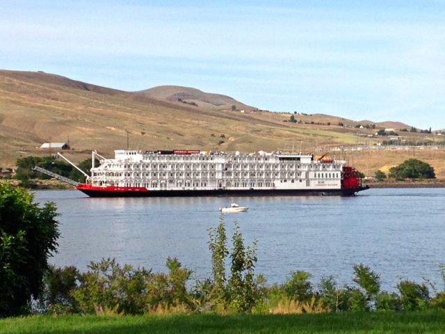
Now we followed Highway 12 toward the Lewiston/Clarkston area and Granite Lake RV Resort. Granite Lake is not really a lake at all - it’s merely that wide area of the river caused by two rivers coming together, in this case the Snake and Clearwater. The RV resort has changed hands since we were here last, and is now owned by Premier, but remains much as we remembered it. Wide level sites, great restrooms and laundry (hey, that’s important!), and the river at your front door. Just a short walk downstream is the Beamers dock, where the jet boats leave on their daily whitewater excursions into Hells Canyon.
A different way of water travel arrived just this year. The 360 foot long, 5 deck high, beautiful white stern-wheeler “American Empress” made her maiden voyage in April. She will take passengers on tours of the Snake and Columbia rivers between Portland and Clarkston. It just so happened she was docked in Clarkston during our stay. That evening, she came upriver and made a majestic turn right in front of the park. Traveling on America’s rivers by stern wheeler, even if the stern wheel is mainly for show seems a fascinating way to see the country. Maybe we’ll decide to trade “one if by land”, for “two if by sea” on a future trip.
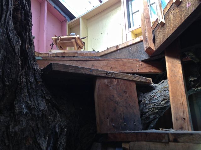
On to Grangeville. We’ve had some difficulty deciding which route to take getting to Great Falls. Should we take Interstate 90? (voted down). How about Lolo Pass, we haven't been there for over a year? Remembering the Powell campground, and its upscale Forest Service RV campground, not to mention a nearby great lodge and restaurant convinced us. Powell, here we come. Now which route? Leaving Clarkston, we could go straight on Highway 12, or loop slightly south through Grangeville. We chose the slightly less “direct route” via Grangeville, and headed to the Bear’s Den. This small 35 space park overlooks the camas prairie, where in early spring, the blue camas blooms from virtual lakes in the prairie grasses. Bear’s Den has a large clubhouse, complete with an ongoing jigsaw puzzle and free morning coffee, super clean bathrooms, and a tree house for kids. Not a platform in a tree, but literally a small house, built around the remnants of a huge tree! Kids would love it - (so did I).
Grangeville is a quintessential Idaho town: small, friendly, and outdoors oriented — with mountains, rivers and back country roads to explore. 4th of July in Grangeville is something not to be missed. If you aren't able to be here for the Fourth, however, on any visit you can visit the ghost town of Florence (Idaho), explore the nearby Weis Rockshelter (pictographs and a great cave), or drive the south fork of the Clearwater River.
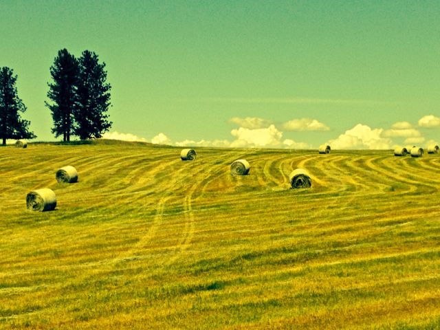
Today, with only a few hours to explore, we opted for the river. We drove east of town a mile or so, and turned right at the sign for Mount Idaho. At the top of the hill we stopped to admire the early season bales of neatly rolled hay.
The road winds up along the mountain, and then steeply drops to the river below. You can follow the river to Elk City, 41 miles upstream, and then continue another 41 to Dixie at the end of the road, Or you can do what a dozen or more folks were doing - fish! It seemed every backwater pool had at least 2 fishermen, and one had 5. They were sitting so close to each other I was surprised they could keep their lines from tangling. And the license plate holder on one car said it all! “Eat - Sleep - Fish, Fish, Fish”!
![]()
Our trip the next day was only a bit more than 100 miles. But our route along Idaho Highways 13 and 12 is narrow, winding and, for the first dozen miles, quite steep. We drove separately down the grade to the Clearwater, hitching up when we got to one of the many river pull out areas. At Kooskia (pronounced “Koos’-kie”), we turned right on Highway 12, and followed it to Lowell. Here two rivers, the Selway and the Lochsa, flow together, creating the Clearwater. Each river inspires thoughts of exploring. But you can only drive up the Selway for a few miles before the road becomes gravel, then dirt, and ends. The one time we were there, several years ago, we found only a few small areas for dry camping, but nothing for a larger rig. It would be great for ATV exploration, however…
Both the Selway and Lochsa carry the designation “wild and scenic”. This means no dams anywhere along them, and nothing done to their banks to detract from their natural state. As you drive along you’ll follow a mile or more of furious river, waves cresting and crashing over huge boulders. Trees, stripped of their bark, become hopelessly trapped in this torrent. Then round a bend, and you’ll find a completely different stream, with only small ripples breaking the surface, and some pools looking inviting enough for a swim.
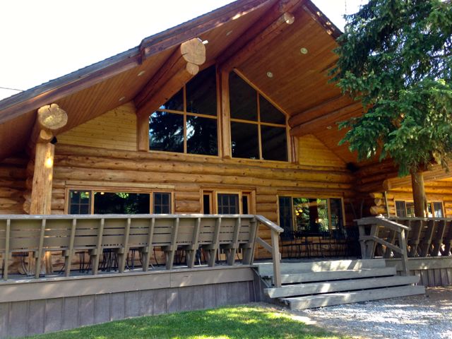
Highway 12 follows the Lochsa for 70 miles to Powell Junction, our destination for the next two days. On our AAA map, it shows only as a small dot, with a red tent indicating a campground. Unlike many forest service campgrounds, however, Powell has 22 sites with electricity - 30/50 amp! Turn off Highway 12, drive past the Lochsa Lodge, (definitely explore there later), and drive down the hill about 1/4 mile to the campground.
When we were here a couple of years ago, it was much later in the summer, and the campground was nearly full. We found the last open spot - and it was beautiful. Today Powell was largely empty, although the reserved signs indicate more RVers in the weekends to come. We were lucky enough to snag site 30, a pull through large enough for two rigs our size - and their toads! Site 30 has two picnic tables, a large fire ring and a hill full of inquisitive ground squirrels. The downside here is no cell or internet service, though you can get a spotty connection at Lochsa Lodge.
The Lochsa Lodge is the perfect place for an Idaho getaway. It's a beautiful rustic lodge with gift shop, restaurant and pub. A tiny “country store” offers limited groceries and camping essentials, plus gasoline and diesel pumps. There are a handful of cabins scattered around its spacious lawns, and a large fire ring area in back of the lodge tempting guests on cool mountain nights. The lodge stays open all year, and the pictures decorating the walls show almost as many snowmobile and cross-country ski scenes as those of fishing and hunting. And it’s close enough to the campground that a not-so-casual suggestion about dinner “out” has a chance of success. Nothing better than a great camp site, an evening fire, and not having to cook dinner.
Now we’re off to Great Falls. The first stop on our eastbound trip was Yakima, where we celebrated our grandson’s graduation from high school. In Great Falls, we’ll join some relatives to celebrate the life of Tom’s aunt who passed away well into her 90s. Then we’ll turn and head back toward Florence, with, of course, some uncharted stops along the way…
Postcard: The Road to Medicine Lake
May 2, 2014
It’s been a few months since we took our Alpine out for an RV excursion other than for a minor service visit, so when Tom suggested we escape the coastal rain and head south for a few days, I jumped at the chance. The weather forecast for northern California seemed perfect. Even a couple of 90˚ days sounded good. We’d head for Durango RV resort in Red Bluff, and the circuitous route would be via Tionesta.
We left Florence around noon, and spent the night at the 7 Feathers RV Resort in Canyonville. Next morning, we drove south toward Medford and followed Highway 140 east to Upper Klamath Lake. From there it was just a short trip south to the towns of Tulelake, Stronghold and Tionesta.
Take a map of the state of California and just try to find Tionesta. Where is it? Hint: Look for a small dot in the far north central part of the state, 6 miles west of highway 139, and 14 miles south east of the Lava Beds National Monument. It’s one of the least explored areas of this interesting and varied state. And it’s home to one of our favorite back country RV parks - Eagle’s Nest.
We hadn’t visited Eagle’s Nest for several years. New owners, Barbara and Craig Rissman, have added a kids play area, but otherwise the park seems just as we remembered. Depending on your perspective, Eagles Nest is either a small or a large park . Small because there are only 20 full hookup sites. Large because these sites are located on grassy lawn of 2-3 acres, and face the neverending sagebrush fields that seem to stretch to the horizon. In the back of the park, a tall timbered hill invites exploration - there are even tables part way up for a rest or a picnic.
The area is a birder’s delight - the first morning I saw a dozen or so cedar waxwings, both an American and lesser Goldfinch, 3 house wrens (and heard others), as well as several song and white crowned sparrows. Several bluebirds were circling the bird houses set up to attract them. And this without counting buzzards circling overhead.
The sign at the park entrance told us to choose a site, and the owners would come out to check us in. However, we had barely crossed the entrance, when Barbara came by. She suggested site 20, on the end of one of the two rows, with excellent views in every direction. She provided us with an unusually used looking hand drawn map of the area showing paved roads (few), unpaved roads, (many) and directions to Glass Mountain and Lava Beds National Monument. In the next day and a half, we’d drive almost all of those roads. And we would even find a few that didn't make her map!
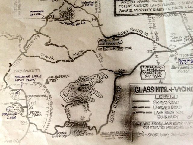
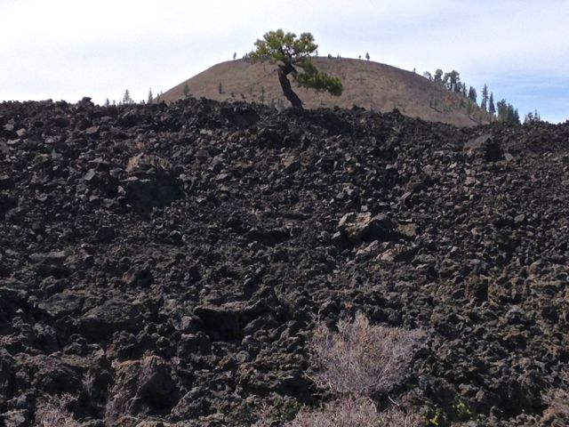
Looking at Barbara’s map, it was easy to see how to divide our exploring days. We started with the Glass Mountain area. Glass Mountain consists of a spectacular, nearly treeless obsidian flow that erupted about 900 years ago and traveled down the steep eastern flank of Medicine Lake Volcano. Our goal this morning was Lyons Peak road, a narrow dirt road leading up the souteast side of the mountain. From a previous visit we recalled seeing huge segments of crumbled mountainside -- tons of what initially looks like ordinary rock, but are actually obsidian boulders. You cannot see much of the shiny black “glass” unless you break a boulder open.
We passed the Timber Mountain store (still closed this early in the year), and headed southwest on USFS route 97. When we last visited this mountain, we had been lucky to avoid most of the snow - with a mountain elevation of 7622’, the road up can be impassible at times. This morning, the warm sun had me convinced we’d get all the way up. But Tom kept insisting we’d be snowed out. And, as it turned out, he was right. As we crossed the 6700 foot line, a snowbank covered most of the road. I carefully walked out on this icy trap to a vantage point for the next turn. More and deeper snow. O.K. We can’t get to Glass Mountain today, or tomorrow, either. What next?
When I packed our lunch, I had hopes of picnicking at Medicine Lake, about 25 miles from Eagle’s Nest. But although we were now within 6 miles of the Lake, there was no way this road was going to get us there. From a “scenic overlook” just down the road a bit, we’d noticed what appeared to be one of the largest lava flows I’d ever seen - a huge black lake stretching for miles across the horizon. The elevation was considerably lower. Perhaps we could get there?
Back down the road we went, to another sign that said “Black Mountain”. (Sounds like lava, right?) We decided to try this “just for a mile”, and turned right down a smooth dirt road. At the end of our mile (and maybe a bit more), the road forked, and we found another sign. This one was completely illegible; we’d have to guess which way to go. One branch went uphill. That way suggested more snow, so we took the downhill fork, again “just for a mile”. At the end of that mile, and just as we were turning around, we noticed a blackness through the trees at the side of the road. We’d arrived at one edge of the Medicine Lake Volcanic Caldera. What an incredible sight! Mile upon mile of jumbled lava rocks, with only a very few scrub pines bold enough to try to grow.
We followed the road as it curved along the lava caldera. At one point, we stopped to follow a short trail to a very deep hole in the lava crust. Looking down into the hole, we could see no discernible lava tube or cave, but we didn’t crawl down to find out. The well worn trail led into the hole and out the other side - uphill to what looked like another such hole. Then the trail entered some trees and was lost from our view. Obviously others braver than we have thoroughly explored this spot.
Now we found another sign - “Medicine Lake, 11 miles”, and from the condition of the road thus far, I think we could have driven it easily. However, 1) getting stuck is not an attractive option, 2) we’d already had our picnic at the lava flow, 3) we had no idea what the road would be like in those 11 miles, (Ms Garmin is excellent at telling you how far you must go, but neither knows nor cares what kind of terrain you'll encounter), and 4) it was getting late. Time to return to our rig at Eagle’s Nest. Perhaps tomorrow, or possibly next visit will be a better choice for further exploration of this fascinating area.
When we travel we always keep at least one eye on the weather, and this was not looking promising. If we spent the next 2 days in Red Bluff, we’d likely be returning through wind and rain. We decided to forgo that leg of our trip, and head back to Florence a couple of days early. But there was still plenty of time the next day for a morning trip to Lava Beds National Monument.
This time we took USFS route 10 northwest for 14 miles to the Visitor Center. Lava Beds National Monument is huge - over 46,000 acres - sitting on the northeast corner of the Medicine Lake volcano. Encompassed in this acreage are more than 450 lava tube caves. With names like “Thunderbolt”, “Blue Grotto” and “Mushpot”, they are a main attraction of the area. Many of these are off limits to the public, but if you want to go “caving”, approximately 2 dozen are open. You can buy a “bump” hat at the Visitor Center, and they will loan you a lantern, free of charge. Rangers give morning walks, afternoon cave tours, and evening campfire programs during the summer months. Within a half mile of the Center, Indian Well campground with 43 sites is quite suitable for tents and smaller rigs.
Preferring my explorations to be above ground, I enjoy touring the historic sites in the area. Near Tulelake, you can visit several sites where the Modoc War took place. This was the last of the Indian wars to occur in California or Oregon. Led by “Captain Jack”, more than 150 Modoc people left the Klamath reservation to which they had been banished and returned to their tribal homeland to take advantage of the lava ridges, cracks, depressions and caves of the Tulelake area which they knew so well. For two years, they waged a guerrilla war against the US Army, outwitting them at each encounter. It’s a fascinating drive - as you roam the area of their stronghold, you can’t help but root for the Modoc. In the end however, Captain Jack and four others were captured and hanged. The other Modoc were sent to a reservation in Oklahoma. It makes one wonder a bit about the iconic images we had growing up about "cowboys and indians"...
Leaving the Visitor Center, we drove northwest past Valentine Cave and turned south on Tichener Road. This appears to be a little discovered circle route leading eventually back to the Visitor Center, and is easily suitable for any car. No 4WD, no high clearance necessary. We found nothing at the Visitor Center "recommending it", and virtually no signs to follow to find it. However this virtually unknown road takes you through some of the best forest/desert scenery in the area.
About 4 miles down this road, I spotted the sign to Mammoth Crater. A short, paved walk up through some beautiful pines brought us to the edge of an enormous hole in the ground. Wow! How aptly named, truly a mammoth crater. Tom estimated its size - 400 yards across, and 100 yards deep. There are no obvious trails leading down into the crater, and the walls were very steep in places. I had to be content with a picture.
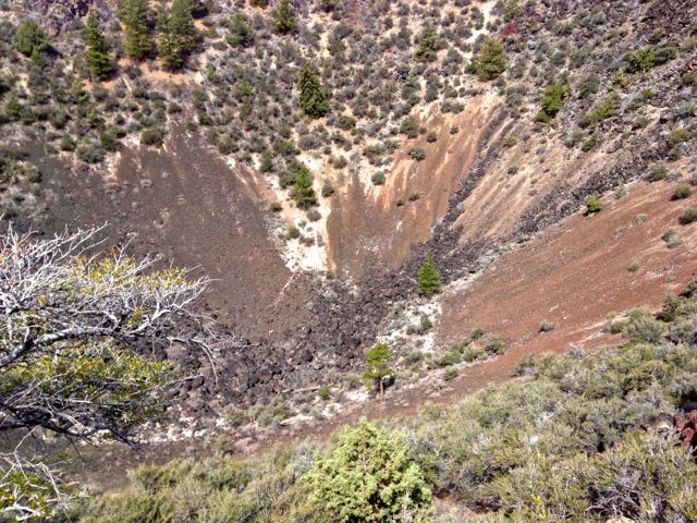
On the short hike up to the top of the crater's edge we noted the rocks strewn about the landscape, while clearly some type of lava, seemed a bit more porous and sponge-like. This inspired Tom to tap one small boulder with his foot -- and it scooted away! These rocks were pumice, and a football sized piece weighed about the same as an actual football. Some are so light and "airy" that they are known to have been found floating in nearby Medicine Lake.
A left turn on Tichener Road took us back to Route 10 and Eagle’s Nest. Time to unhook, hitch up the Jeep, and head for Florence once again. We’ll spend a night at Casey’s RV park in Westfir and be home in time to avoid the worst of the oncoming weather. It’s been a great few days, we need to come back here again, soon.
Postcard: Louisiana Ice Storm
January 29, 2014
From Spanish Fort Ala, we headed west toward Houma, La. As we traced the Mississippi coast, we saw many areas which still showed the effects of Hurricane Katrina. Houses had been blown off foundations, while driveways, still paved, lead to overgrown and eeriely empty plots of ground, each with some flavor of a sign that advertised the real estate as "available". It's one thing to read about this sort of devastation, but quite another to see these extraordinarily destructive effects mile after mile. It's even more remarkable to remember that Katrina came ashore 8 years ago.
A winter storm warning had been issued for the State of Louisiana (and a good portion of the southern states as well). The same system which had dumped snow and brought arctic temperatures to the winter weary central states was headed our way. Local TV pundits were cautioning against even going outside for the next couple of days. Schools and businesses would be closed. Roads would be treacherous, and many of them would be closed as well. None of these were welcome advisories to people like us that were simply contemplating a leisurely sight-seeing trip by car through the back country of this area!
I must admit that I thought that the State of Louisiana was exaggerating. Close schools, businesses and roads just because the temperature might go below freezing? Folks for whom winter is merely less sunshine and warmth couldn’t possibly know what a real winter storm is like. Over the next 24 hours, however, I became a believer. This Louisiana ice storm was quite unlike anything we’ve experienced in the Northwest.
The afternoon weather in Houma, while brisk, was far from threatening. However, later that evening, it began to rain - just a faint shower at first. So far, the forecasters seemed right. We discussed waiting it out, extending our stay here for an extra day, and came down to breakfast the next morning prepared to do just that. But the small eating area, virtually empty the evening before, was jammed with people, and the hotel was fully booked. The offshore oil rigs had evacuated their workers, and Houma was the closest city. This was starting to look a bit more serious than we thought. Perhaps we should get to Lafayette before the storm hit. Forgetting breakfast, we returned to our room, rapidly packed and headed out.
It’s just over 100 miles from Houma to Lafayette, 4 lanes all the way. An occasional stoplight will slow you down, but mainly it’s the traffic that you’ll remember. Not so this morning! It seemed everyone but us was heeding the warnings, and taking the day off. It's an odd feeling driving down a usually busy freeway where the speed limit is 70 mph and seeing no other cars for a mile either in front or in back. The instinctive thought is "these people must know something we don't know"!
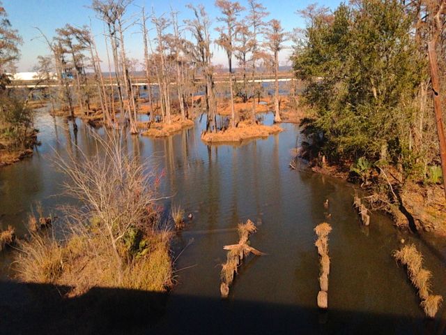
Much of Louisiana is so flat that in many spots you can look for miles across to the oil rigs on the horizon. Because of this low swampy terrain, crisscrossed by bayous, many of the roads are elevated. Every time a road crosses a waterway, there’s a bridge.
Each bridge comes complete with sign --“Bridges freeze before roads”. Usually we’d ignore these, but not this morning.
Today, on either end of each major bridge was an empty police or sheriff's car, always with lights flashing. At first we thought these cars were simply to reinforce the warnings about icy bridges; but soon we concluded they were there simply waiting for the order to block and shut down the bridges! Fortunately the road remained dry, and Tom made good time almost all the way to Lafayette. Some 20 miles south of town, a slight rain began, the temperature started to drop, and we had to slow. But the roads remained passable.
We got to our hotel around noon, and, after checking in, took a short exploratory drive. Virtually every business was closed, and the street traffic was minimal. We spotted an open Albertsons grocery, and stopped for a couple of items. I asked one of the checkers if they would be open that evening. “We don’t know yet,” she responded. “If there’s a curfew, of course we’ll close”. A curfew?!
We returned to our hotel, noting that in addition to banks and businesses, stores and schools, some gas stations and the neighborhood restaurants (including our favorites Blue Dog Cafe and Guidry’s Reef), were also closed. The Hilton, just across the street, had a restaurant. Surely that would be open. It was, but the gal at the desk cautioned us that, because very few of their staff had made it to work, it would be buffet only. Back to Albertsons - did you know you can microwave a pizza?
Mid afternoon, it began to rain -- rain that froze instantly when it hit the windows of our room. We’re used to cold weather precipitation in the form of snow, but instead of snowing, it was ice-ing. It took very little time before the cars in the parking lot resembled ice sculptures, and walking was treacherous. As we watched the evening news, our suspicions were confirmed as to why those police cars had been parked by the bridges. One by one, the State of Louisiana had closing bridges and roads, including the Interstate. Closing the Interstate takes orange barricades - to close a bridge, they simply had the police move those cars into the mid point of each - no one’s going around that!
By mid-morning next day, the weather had warmed a bit and the sleet had stopped, so we headed to Abbeville. The back roads were still fairly icy, and the few cars we encountered were heeding the weather warnings, driving very slowly, even on the major, relatively ice free, roads.
Even though we don’t have our RV with us, it still feels like “coming home” when we go to Betty’s RV Park. Today, her small park was absolutely full - 17 rigs, and 2 more dry camping - as has been the case every year since we first stopped here years ago. Mardi Gras season is especially popular, and, each year, Betty seems to have extra festivities up her sleeve. This year, they’ve rented a hall for a Mardi Gras Ball. All the RVers will be dressed in full Mardi Gras regalia - the women in ball gowns, - courtesy the local second hand store - the guys in Mardi Gras colored shirts and jackets. They’ll have a great time. Wish we could join them.
I’m absolutely convinced that Betty knows everyone in Abbeville. She surely can direct you to the best restaurants in town for a delicious meal. During our conversation this morning, she recommended lunch at “Shucks” oyster house, insisting the owner would defy the closures and remain open for business. We simply can’t resist one of Betty’s recommendations, so before heading back to Lafayette, we stopped for a great Cajun meal of seafood gumbo, (me) and crawfish Etouffe, (Tom).
While we were there, one of the owners of “Shucks”, stopped by our table. David Bertrand introduced himself and asked the usual questions about how we were enjoying our meal. When we told him his restaurant had been recommended by Betty, he all but sat down with us. He talked about Cajun cooking, which he described as very simple, its basic ingredients being onions and bell peppers. David obviously loves his restaurant and the people who work there. When he bought the place, he made sure that his chefs continued using their “tried and true” recipes. When he added something new, he used recipes handed down from his grandmothers .
David had known Betty (he called her “Miz Betty”, which I loved) since he was a child working at the family grocery store. David further discussed growing up in Abbeville, the folks of Vermilion Parish, and the close knit Catholic Cajun family. One of his stories recalled how everyone in town worked to help their neighbors during Hurricane Katrina, without “having to ask the government for help”. (A not so subtle dig at New Orleans). The Abbeville sheriff went on the local radio station to ask neighbors with boats to help evacuate those in danger from the rising water. Within the hour, David said, there was a line of trucks and boats stretching from the town center all the way across town.
Testing the roads for continued iciness, (the temperature seemed stuck at 37°), we took a roundabout route back to Lafayette, and continued on to Beaux Bridge and the Bayou Teche. Even though we are fewer than 20 miles from the city, it’s very easy to get lost in this area. We know -- we’ve done it.
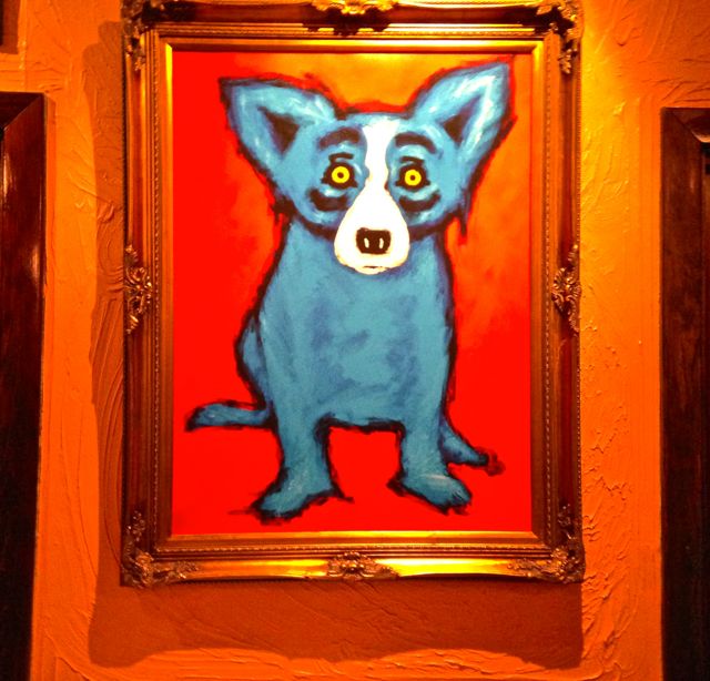
As the afternoon progressed, the weather grew a bit warmer. But many of the roads remained closed, and schools wouldn’t open for at least two more days. However a few of the restaurants were slowly beginning to awaken. On a whim I called called Blue Dog Cafe. Only a few hours earlier we'd driven by at what is usually a very popular lunch hour there. The cafe was completely dark, with an empty parking lot. But to our surprise and delight it was now open, and we'd have one final date with Cajun cooking. In addition to its cuisine, it's known as well for the incredible number of paintings that literally cover the walls -- all depicting various forms of the "blue dog" from which it derives its name.
Tomorrow, we’ll head back to New Orleans to take the City of New Orleans to Chicago. There we’ll change to the Empire Builder and take the northern route back to Portland. Just how long this last leg of our trip will take is uncertain - due in part to freight traffic the Empire Builder has a terrible on-time record. But we’ll eventually arrive back in Portland and this fabulous loop trip will be over. It doesn’t seem possible we’ve been gone nearly 2 weeks.
Today is Super Bowl Sunday. Our train, while 3 hours late so far, should deposit us back in Portland in time to watch the game. Tomorrow, we’ll return to Florence. Back to the more familiar routine, which fortunately includes planning our next trip...
Postcard: From Waterslides to Wilderness
January 27, 2014
Meals on Amtrak are a community experience. Every table seats 4, and the dining room staff fills each table before starting a new one. if there are 3 or fewer in your group, you will be seated with someone you've probably never met. Meals might start a bit awkwardly, but by the time you are finished, you've made new friends. One of the opening questions, right after "where are you from?” is " where are you going?" When people found out that Tom and I were headed to New Orleans, and that we weren't going to stay there, but drive instead into the countryside, we got some incredulous stares. Why would anyone not stay in such an interesting city, spend time in the French Quarter, eat beignets at the waterfront, etc.
We've been to New Orleans numerous times, mostly business related -- so it's not new to us, and we really prefer the countryside to any big city. We’re “grey line” travelers whenever possible. So, after picking up our rental car the next morning, we plugged in Ms. Garmin, (an indispensable part of every trip), and headed north into Mississippi. Our itinerary, (subject of course to change at a whim), is to spend a couple of nights at Spanish Fort, a town just east of Mobile, Alabama, and take a loop trip from there. We’ll cross Mobile Bay on the Dauphin Island ferry. drive the Alabama coast, detour through a bit of the Florida panhandle, and return.
About 5 miles across the line, just south of Picayune, Tom pulled into a Visitor Center to get any additional detailed area maps or brochures. This Center was a large, attractive building located on 20 - 30 treed acres, just perfect for picnics or hiking. Inside was gaily decorated for the upcoming Mardi Gras, with traditional green and purple streamers, masks and beads everywhere. But the piece de resistance was Ed.
He stood at the end of the main room, right in front of the Mardi Gras tree. He was dressed in the white coat of a chef, with a cap reading “Big Ed”, perched on his head. On a table in front of him was a table with a huge metal steaming caldron of something that made my mouth water. “Would you like some crab/shrimp bisque?” he asked, and ladled me a large portion. It was simply the best bisque I’ve ever tasted. Not too thick, just spicy enough, and full of pieces of crab and shrimp. Before I was had finished more than a few spoonfuls, he offered me a piece of King Cake, the traditional Mardi Gras treat. I had a choice between cream cheese and pineapple cake. Again, absolutely delicious. Big Ed told me that since my piece didn’t have the baby in it, I didn’t have to buy a cake to share with everyone. His way of explaining a Louisiana Mardi Gras tradition.
Ed works at Paul’s Bakery and restaurant, so we immediately put it on our itinerary. The small bakery is one we probably would have driven by without knowing where it was or what we were missing. If so, we would have been about the only ones for miles around not there. The bakery section was stacked with King Cakes and other pastries with Mari Gras decorations everywhere. We ate in the small restaurant - more crab and shrimp bisque, again absolutely wonderful. And all that from a casual stop at a Visitor Center in southwestern Mississippi.
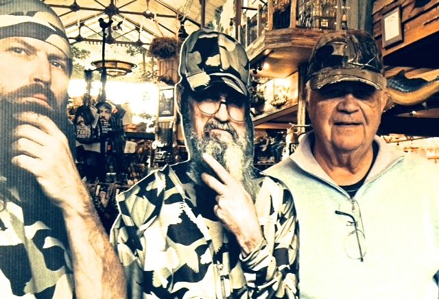
When we planned this trip, we thought we’d be staying in Mobile, but for some reason all the hotels were full. Why? We later learned the college Senior Bowl was being played there on the Saturday of our arrival, and everyone knows how much the folks in Alabama like their football! The Marriott Courtyard in Spanish Fork was extremely nice, and had the added attraction of being just up the road from a Bass Pro shop. This chain is largely located in the east and southeast, and this was our first visit to one. Just inside the front door, a large cutout of the Duck Dynasty clan simply demanded us to take pictures! Tom also got a camouflage cap. When we got back to the motel, and he put it on, I noticed the bill was frayed on the end. “If you have the receipt, we can return it, and get a new one”, I said. But the receipt read, “1 cap - frayed”. Frayed clothing is very popular these days. Guess I need to get more up to date!
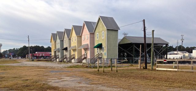
Early the next morning, we drove south across the causeway to Dauphin Island to catch the ferry to Fort Morgan. The boat left at 9:30, and my years on San Juan Island have instilled in me a great need to be on time. We were so early that no one was even in line, so we went back to the small market area to get a quick breakfast (Subway), and snap a couple of pictures. A row of rental houses caught my eye. I couldn't help but wonder if someone living in one of these might feel just a bit "confined"...
Even with this delay, we were second in line for the ferry - and only 2 other cars made the crossing of Mobile Bay with us this morning. In about 30 minutes we’d crossed to Fort Morgan. This fort was built in 1834 in an attempt to protect Mobile Bay from Union forces during the Civil War. During the Spanish American War 5 new batteries were added, all abandoned by 1920. Today a Visitor Center details the history of the Fort, and you can walk among the remains of the old redoubts.
It seems that every road, from major thoroughfare to the thinnest of grey lines leads to Gulf Shores, a quintessential tourist town. Here, along a beautiful white sand beach, a long line of hotels invites visitors. It was hard to tell how crowded these were on this chilly morning, but judging from one hotel sign: “Prayers get answered - vacancy”, they must be quite full.. However, the beaches had only a scattering of walkers and a half dozen hardy surfers braving the waves.
The hotels line the beach; but right behind them are legions of tourist attractions. The waterslides are closed until March, but the souvenir shops were wide open. A large purple octopus sits over the entrance to one set of shops. If you want an “olde time photo” taken, or are in the market for t-shirts and swimwear, this is the place to go. We gave our award for the most “touristy” to the entrance to another set of such shops, which invites you right into the shark’s mouth, and down his throat! Great marketing: kids surely woud drag their parents into this place!
We followed the coast east just into the Florida Panhandle. A helpful volunteer at Perdido Beach Visitor Center showed us a large map of the Perdido Beach Bay, just where the Intracoastal Waterway was located, and various back roads leading to uncharted beaches. We followed one of them to a beautifully empty beach, but it was time to head inland, and find a back country return route to Spanish Fort.
The shortest way would have been to drive Interstate 10, following it almost to Mobile. But that seemed a bit dull. We choose the grey lines through Seminole and Elsanor, Gateswood and Crossroads. As we drove through the pine forests of Alabama, we remarked how different it was here from the cluttered, touristy areas along much of the coast. We drove for miles without seeing another road or house. There was nothing but pines, kudzu vines, and cypress trees in swampy ground. Even Ms Garmin showed no roads at all except the one we were on until we were nearly back to the motel. Truly beautiful, truly wild southern wilderness.
Tomorrow, we head west to Houma for one evening, then to Lafayette for a couple of days. The weather doesn’t look the least bit promising - an ice storm is forecast, and there is talk of closed roads and bridges. And, because of the swampy topography of Louisiana, there are 13,127 bridges here. But how can I write a postcard if nothing interesting happens? Right now, it doesn’t look like that will be the case.
Postcard : The Tortoise and the Sunset Limited
January 25, 2014
Amtrak's "never on time" reputation is well known among train crews, and at least one of the crew on the Sunset Limited feels a bit defensive about it. When the Limited's dining car steward learned we had just come from the Coast Starlight, he was a bit condescending. "We call them the Star-late", he remarked, "it's not unusual for them to arrive 3 or 4 hours behind schedule".
Perhaps he should not have said that. Our train had been holding its own against the clock when it neared San Antonio this morning shortly before 5 AM. About 5 miles from the station, it came to a halt. I was only half awake, and my bunk, the top one, gives only the barest peek outside, so I was only vaguely aware that something was amiss. Tom, on the other hand, was awake enough not only to know that we were stopped somewhere outside the station, but also awake enough to use his iPhone map app to figure out just where we were. (Short of getting up and asking a crew member, that's the only way he could have known, because there is an unwritten rule against announcing anything over the loudspeakers before 7 AM). For almost 2 hours the train remained motionless, 5 miles from its destination. What the weather gurus have been calling the Mini Polar Express (actually, just the first of two as we would soon learn) had arrived.
We knew that Texas and the Gulf Coast were due to experience some very cold weather, but that it would neither be as cold as the system before it, nor last as long. What it brought with it, what would cause most of the problems over the next 24 hours, was ice. Ice causing train tracks, and their switches, to freeze. Ice prompting the closure of many roads, including the long causeway over Lake Pontchartrain.
Finally, the train started to move — but oh, so very slowly. The freezing weather had disabled all the signals in the yard. The train would approach one crossing, find a red light, and then back up to try another track in hopes of finding a working signal and a green light. When we were moving forward, it was at the proverbial snail's pace. Moreover San Antonio is a train maintenance stop. We couldn't make up time here by leaving early. No matter when we arrived, we had to stay until all the work was done.
It's a 5+ hour run from San Antonio to Houston, and we thought we might gain back some of our lost time then. But we hadn't figured on freight trains. A couple of times we had to pull over to let those behemoths by, and these particular ones were traveling at a very slow speeds. When we finally did get to Houston, there was one just ahead "on our track", according to the conductor, and we had another lengthy wait while it got out of the way so we could pull on into the station. Another hour bit the dust.
Off to Beaumont. One more delay, this time a combination of weather and railroad rules. According to union rules, crew members may only work a 12 hour shift before a replacement crew is required to take over. The replacements for our crew were supposed to be waiting for us at the Beaumont station. Those crew members who needed replacing would get off the train, and the new crew would get on. All very smooth and swift, right?
However, it didn't work out quite that way. We pulled into the station, and the detraining passengers got off. Anyone else who wanted a break - for a short walk or a smoke (Amtrak is 100% non smoking on board), also got off. After about 10 minutes, the "all aboard" call came. But the train didn't move. Finally, a voice came over the intercom. "We're waiting for our new crew. Due to the icy roads, they've had to drive around some road closures and are running late. Hopefully they'll be here soon. Sorry for the inconvenience".
It just so happened that Tom was standing next to the woman making this announcement. She explained that some of the train crew members had worked almost their complete 12 hour shift. "They almost died", she said, referring to their status approaching the limit of the 12 hour rule. "A couple of them looked like it!", he joked.
Now our scheduled arrival time of 9:40pm has been pushed back almost three hours. All the train travelers seem to realize that there are some things, like ice storms, that are unavoidable, and everyone seems in good spirits. I haven't heard anyone gripe that they are missing an appointment or important meeting. We have a hotel waiting for us in New Orleans, and a rental car will be ours in the morning. Next phase of the ultimate loop trip, exploring the Gulf Coast, is about to begin.
Laissez les bon temps rouler!
Postcard: The Ultimate Loop Trip
Jan. 25, 2014
January - cabin fever month. Now is the time when those of us who live in the Pacific Northwest begin to think about travel to warmer climes. But where? Our RV is snug in our garage in Florence, and the idea of loading up and heading south now - in the heart of snowbird season (and potenially snowy road season in the Siskiyous), with its crowded wintertime RV parks - somehow seemed like a lot of trouble. Where to go, and how to get there -- that was the question.
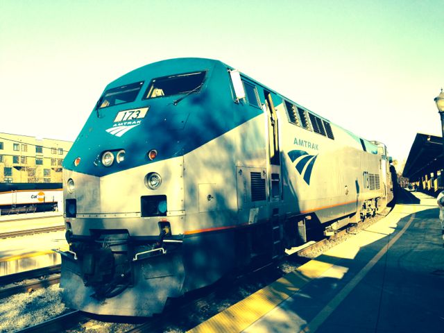
And the answer was - AMTRAK! When Tom suggested taking an extended train trip, I thought it a fantastic idea. Take the Coast Starlight from Portland to Los Angeles. We boarded her in Portland, and captured a quick shot of the power that would be taking us south.
We should be just in time to catch the Sunset Limited bound for New Orleans. There, we'll rent a car and explore coastal Mississippi, Alabama, and a bit of Florida. Then we'll return to Louisiana, and plan to spend a couple of nights in Lafayette. We'll be early for most, if not all, the Mardi Gras celebrations, but right on time to revisit one of our favorite areas, the Cajun country, and stop in to see Betty at her RV park in Abbeville. We know for certain that with an RV or without, we'll be welcomed with open arms, and thoroughly briefed on the local Cajun doings. Betty is like that. Whether you are an old timer at her park, or just stopping in for the first time, you will feel at home.
The Coast Starlight runs between Los Angeles and Seattle, with connections from the north (Vancouver, BC). It makes this run, each way, every day, following the coast in several especially scenic areas. From Seattle, it travels to Portland, then Eugene, with multiple stops between cities. Next it heads over the Cascade mountains to Chemult, Oregon, to pick up travelers from the high desert communities. In California, the tracks run through Redding and Sacramento, then back to the coast south of San Francisco. You will spend two nights aboard either in large reclining chairs (coach), or sleeper roomettes. Tom and I have always opted for the fairly small, two person roomette - two facing chairs during the day and two bunks at night, though larger rooms are available.
The crews on these trains are thoroughly convinced that the Coast Starlight is simply the best in the entire Amtrak system. One of their arguments is that no other train in the Amtrak system includesa Parlor Car. This is a car reserved for sleeping car passengers only. It's comprised of a small observation lounge and private dining area. Each afternoon wine tastings are hosted here. Three or four different wines from the area are sampled, and several varieties of cheese, also local, accompany the tasting. Today, we tasted a Pinot Gris from Oregon, a Cabernet from California, and a Syrah from Washington. The cheeses were also regional and delicious- the smoked mozzarella and one lavender infused cheese were immediate hits. I could can almost imagine being on one such car in the early days of rail travel, watching gloved, white coated waiters serving formally dressed patrons. According to our Parlor car attendant Daniel, Amtrak is planning to discontinue this service, and then the last vestiges of long ago rail travel will be gone.
Be it from your room, the Parlor Car or the larger observation car, the views from the Coast Starlight are unparalleled. This trip, I watched the sun rise over the Sacramento River Delta, and then watched it set over the Pacific just north of Santa Barbara.
There's an RV park perched on the bluffs overlooking the water - it's always looked inviting, and today there was plenty of room. Maybe on our next trip south...
AMTRAK has a fairly well earned reputation for being late. Hours late. And we were somewhat concerned about our first connection with the Sunset Limited in LA. We were due in at 9pm; the Sunset Limited was scheduled to leave at 10. But this connection was "guaranteed" - we would not miss the train, even if it meant being expedited via AMTRAK bus from Sacramento or Santa Barbara. But this time we were actually a few minutes early. Hooray!
Postcard: Organ Pipe Revisited
November 27, 2013
Tom’s been tracking our RV travels over the past few weeks. From Palm Canyon State Park in Borrego Springs to the Voyagers RV resort in Tucson, we’ve covered a fairly wide range of RVing accommodations. Now we’ve come to one of our favorite spots - Ajo Heights RV park in Ajo, Arizona.
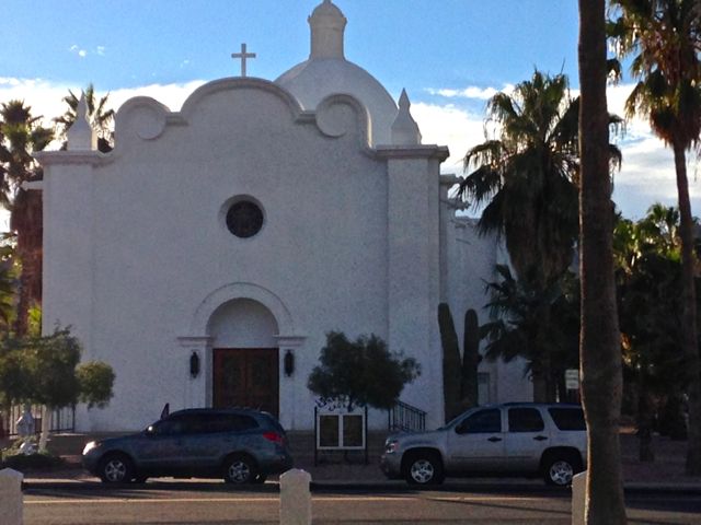
Ajo is a picture book town with a traditional central town plaza - a large central area ringed with tall palms. It’s surrounded on three sides by small shops and on the fourth by a large, dazzling white Catholic church.
Ajo Heights RV park is a wonderfully friendly spot. Each afternoon at 3, you’ll notice a group of RVers gathered in front of one rig. Everyone brings a chair and beverage, and for an hour or more relates the day’s adventures. Afternoon laughter rings loud at Ajo Heights.
For us, staying in Ajo has an added advantage. 32 miles south is Organ Pipe Cactus National Monument, one place we’ve been visiting for over 20 years. It’s still a wonderful place to explore - but how it has changed in the last few years.
Drive 10 miles south from Ajo on AZ 85 to Why. Arizona. Question: Why is Why called Why? Answer: Originally two Arizona highways, 85 and 86, intersected here, forming a “Y” in the road, and a small town sprang up at that intersection. At that time, Arizona law required that a town have at least three letters in its name, so the town couldn’t be called just “Y”. Town fathers decided on Why, and it stuck. (You’ll look in vain for that old “Y” intersection - the department of highways later made it into a more conventional “T”. ) From Why, it’s about 22 miles south to Organ Pipe.
At first glimpse, this area seems exactly the same as it has for years — and no doubt for centuries. Why is the same small unincorporated community (pop. 116 in 2000). The road through the desert is the same, a winding two lane road cresting hills, traversing dips through spectacular desert scenery. But there are differences.
A few miles south of Why a large sign reads “Entering Organ Pipe Cactus National Monument”. That sign used to include the words, ”Twin Peaks Campground, 23 miles. Campground usually full by 2 pm [or noon, etc]”. That wording is gone. No reference to any campground will be found for several more miles, and certainly no reference at all to when it will fill. The wording has been removed because the campground hasn’t been full for years. Concern over illegal immigrant activity has frightened away many of the RVers who used to pass each other on the road south through the Monument - each trying to get to the Campground first. No reservations were accepted, and first come, first served was the rule.
Just outside the Monument entrance, we used to see scores of campers enjoying a free desert camping experience a few yards off the road. Today, we saw two. A few miles further on, there is now a border patrol checkpoint. Cars going south get through with a wave of the hand; those coming north are stopped. We were asked our names, citizenship, where we had been, and then the agent requested to look into the back seat of the Jeep.
The Visitor Center is now named the Kris Eggle Visitor Center in honor of the ranger killed here in 2002. His murder, by members of a Mexican drug gang, added to the apprehensions felt by people about even visiting this Momument. Today, the parking lot was empty except for our car and 4 bicycles. The Ranger on duty told us that at any given time there were probably more illegals here than visitors and Park personnel combined. Apparently there have been no confrontations, and the park is considered much safer than other national parks where theft is often commonplace. His main complaint about his job was that it was “boring”. But it’s a beautiful place to be bored!
Twin Peaks campground is about a mile up a paved road from the Visitor Center. No more the strings of campers and RVs lined up at the entrance - today even the entrance kiosk was not staffed. In the available 208 sites, I counted 10 RVs of varying sizes and 2 tents. We realize that it’s still early in the snowbird season, and that most campers won’t arrive until after Christmas; still it was a bit dismaying to see it so empty. The few RVs that were there had the spectacular views south toward Sonoyta, Mexico, all to themselves. And the sunsets over the abundant display of organ pipe and saguaro cactus will be nothing short of spectacular.
But “the more things change, the more they stay the same”. If the popularity of the Monument has been hurt by border events, the desert retains its unique allure - stark and beautiful. Today’s bright sun fairly demanded we drive the 21-mile Ajo Mountain Scenic Loop.
Organ Pipe Cactus National Monument covers 516 square miles of Sonoran Desert bordering Mexico. 95% of it is designated wilderness. There are only two drivable roads through the park, the 21 mile Ajo Mountain loop and the much shorter Puerto Blanco Drive. Our afternoon had just enough time left in it for Ajo Mountain. And what a spectacular drive it was…
The drive begins just across from the Visitor Center. The road is mostly gravel, with paving reserved for the many dips along the route. Due to the twists and dips in this road, RVs over 25 feet are not permitted, but 4WD is not necessary under most conditions. There are several pullout places along the road, and in high season, you could expect them to be filled with picture takers. Today we shared the road with only a handful of other cars.
While you can stop and walk into the desert wherever you wish along this road, there are three main “picnic” spots. The first, atop a small rise, looks out toward Tillotson Mountain. The second is at Arch Canyon. Here, a mile hike will take you from the parking area to the arch, although descriptions of the last bit of this hike warn that “the last scramble” is not included in the trail distance. The third is the Estes Canyon trail to Bull Pasture.
Tom and I hiked this trail several years ago. We remember seeing a herd of Javalina in the brush just below us. We remember scrambling across an area of fairly steep rock face, getting from one part of the trail to the next. We remember the lovely high mountain meadow that comprises bull pasture, and is so named because nearby ranchers took their cattle up there during the hot summer months. However, 3 PM is far too late to contemplate this steep, 2 mile (each way) hike.
We weren’t the only ones enjoying the late sunshine. Perhaps this is another reason I wasn’t too anxious for a “nature walk”.
For now, it was time to complete our loop and head back to Ajo, Tomorrow is Thanksgiving, and we’ll spend it in Yuma with our son, daughter-in-law and her parents. Then, with one eye always on the weather, we’ll start our trek north again...
POSTCARD: Desert Backroads
November 12, 2013
Heading south. An overnight stay at the Orange Grove RV park set us up perfectly for the run to Emerald Desert RV Resort in Palm Desert - even factoring in the anticipated wind along the way. Almost as predictable as finding wind at the Weed airport in northern California, you can expect wind as you drive east from Bakersfield. The first gusts hit as you near the top of the Tehachapi Grade, increasing as you pass the well positioned wind farms just east of town, and becoming downright bothersome side winds through Mojave and Lancaster. Then the wind generally lessens - until you get to Beaumont and Banning and drop down into Palm Springs.
We spent 3 nights at Emerald Desert. The first night the park was fairly crowded. A big celebration and parade in Palm Springs the day before had brought many RVers there for the fun. By noon the next day, most had left - except for us and 50 RVs attending an Adventure Caravans Mega Rally. The coaches had taken over a good portion of the largest section of the resort. Each was adorned with a large yellow sticker proclaiming the number of “adventures” they’d taken. Most stickers had large 2s and 3s on them, but I saw four 5’s, one 17 and a 22!
Some 14 years ago, we joined an Adventure Caravan tour to Mexico’s Copper Canyon, and seeing these adventurers brought back many memories. We couldn’t help but reminisce with Pat and Alice Maitland, tour directors for this rally. This Mega Rally would be 11 days long, with 4 days of bus trips in and around Palm Springs and the surrounding areas. There were tours of Joshua Tree National Park, several Palm Springs museums, and of course the Palm Springs Follies. The rally attendees were certainly an enthusiastic group. I watched one afternoon as a Rally couple worked on convincing 2 of their non-rally neighbors to join a Caravan trip. They had given out the latest club magazine and newsletter, and now were trying to get the potential Adventurers to attend that evening’s get-together.
Travelers to Palm Desert, or Palm Springs or La Quinta or any one of the dozen or so little towns that comprise Greater Palm Springs, probably head to the El Paseo district for shopping, or to one of the many golf courses in the area. There’s fine dining at your fingertips - and in short, all the comforts that a big city can provide. And for some, that’s great. It just isn’t what attracts Tom and me to this area. We much prefer the outdoors - finding the real desert. And that means a return trip to Joshua Tree National Park.
Take “the 10” west to Desert Hot Springs, and follow the road through Morongo Valley to 29 Palms. Turn right, and head to the Park entrance. Be sure to stop at the Visitor Center for the latest park information. And hope that you’ve brought along a jacket and perhaps long pants. Joshua Tree is a bit over 4,000 feet and can be a lot cooler than the valley below.
Tom & I have driven through the park on many different occasions. We’ve camped at Cottonwood Spring, and White Tank campgrounds. We’ve visited when the wildflowers were out. We’ve watched rock climbers in various precarious (or so it seemed to us) situations. But somehow we’d always followed the same path - in from the northeast entrance, out at the south, or vice-versa. That route is about 45 miles long. 45 miles of stopping to read the informative signs along the way, of exploring some of the huge jumbled rock formations, of taking little side tours to places like Barker Dam, or the Cholla Cactus Garden. That way, 45 miles can take most of the day - or longer. You may find yourself planning an impromptu overnight. Today we had time only for a short loop. We entered through the west entrance, and drove east. Destination -- Skull Rock.
The road, here called Park Boulevard, climbs slowly through the Joshua trees toward Hidden Valley, one of the many small campgrounds protected from the wind by the desert rocks. These little campgrounds are best for tents or small rigs. They have picnic tables and fire rings, but no hookups.
From Hidden Valley, we drove over Sheep Pass toward Jumbo Rocks campground. Just outside this campground the sign reads “Skull Rock” And there it is, deep set “eyes” glaring at you from its den as it peeks out over the protecting boulders...
We might have spent more time here today, but we hadn’t followed our own advice. Both of us were wearing shorts and sandals, which were very comfortable in the low desert where we were staying -- but not good attire for the high desert hikes here. Add to that the fact that the wind was blowing and temperatures were barely into the 50s. Time to return to civilization. Back to Palm Desert and the coach.
Emerald Desert, or what’s left of it, is still a beautiful park. The owners have refurbished the clubhouse, and it is a great spot for “super rallies”. The tennis courts are still in daily use, and at least one of the two putting greens is usually busy. But I can’t help but remember it as it used to be - before a large part of it was sold for development. Now, it’s a good first stop on our desert journey - but for us at least not suitable as a final destination.
Especially not with Borrego Springs only 75 miles away (35, if you're a crow). A short drive to a remarkably different desert experience. It always amazes me how this little town, (pop. 3249 in 2010), never changes. True, this year, the old grocery store has become an art gallery, and La Casa del Zorro hotel and restaurant has reopened. But other than that, everything seems the same. Surrounded as it is by the huge, (916 square mile), Anza Borrego Desert State park, there’s very little room for expansion.
Winter camping here is extremely popular, but, even with the looming Veteran’s Day holiday, Tom managed to find us a prime slot in the full hookup section of Palm Canyon campground. After hooking up, one of our first stops, as usual, was the park visitor center. There is a wealth of information here - start by watching a short movie about the desert, then explore the center. The volunteers at the desk are very knowledgeable about this special piece of desert.
Wander through the several dioramas - one of the desert birds and animals at a waterhole, another of the lives of the indigenous Kumeyaay Indians, and still another describing a catastrophic earthquake of some years past. You’re in Southern California - earthquakes are not uncommon experiences. And, of course, there’s always the gift shop!
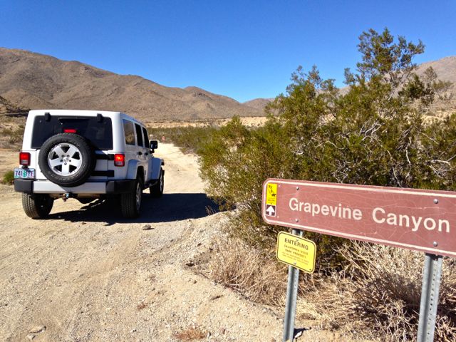
One of our favorite pastimes here is driving the many jeep trails that cross the desert. There are dozens of spots you can take a vehicle - some OK for 2WD, but most requiring at least high clearance. On one wall of the center, a chart lists the various trails - and their current driving conditions. Or at least what the conditions were when last reported. This is not necessarily done every day, or even every week, but has usually been fairly accurate. It’s a good idea to check with the volunteer desk. One of our favorites is the Grapevine Canyon trail.
Two main roads lead west from Borrego Springs. Highway 78 takes you southwest up the Banner Grade to the mountain town of Julian. A bit north, highway S22 goes up the Montezuma Grade to Ranchita. Both roads eventually join and head out toward San Diego. But well before that, there’s another connecting "road" you can take. Grapevine Canyon is 12+ miles of steep, rocky, narrow jeep trail connecting these two major routes. If you’re headed west, there’s absolutely no reason to take Grapevine Canyon. Both of the other roads are faster, smoother, and no where near as interesting. We checked the Visitor Center chart on road conditions. According to the chart, we’d need 4WD and the road condition was currently rated as "poor". We have 4WD, and the road conditions on this trip varied from OK to “quite a challenge”.
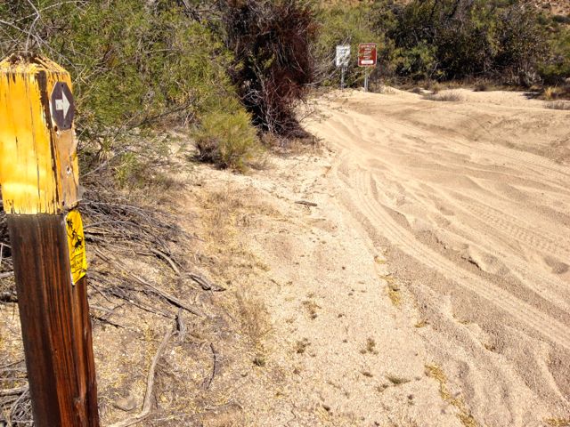
Following the signs to Julian, we drove south from Borrego Springs, and turned right at La Casa, heading up toward Yaqui Pass. We passed Tamarisk Grove campground, and Yaqui Well. Just after the left hand turn to Plum Canyon, and right before the road began its climb into Sentenac Canyon, we found the tiny weathered sign reading “Grapevine Canyon”. If you're not looking for it, you won't see it.
The first few miles of the Canyon trail are fairly flat. But about halfway along (6 miles), the road rounded a turn and began to climb steeply. It became steep and narrow with deep ruts and gullies slashing across it. Large rocks littered the trail, some requiring a bit of off-road experience (Tom's, not mine) to get over or around. Violent late summer and autumn rains had made an always rough jeep trail even rougher, and we were glad to have our compound low gears available. We climbed and bounced for about a a half mile, at times tilted at a frighteningly (to me) angle. We were glad to meet no other cars on this rutted route - the only other vehicle we saw on this trip was a medium powered dirt bike (motorcycle).
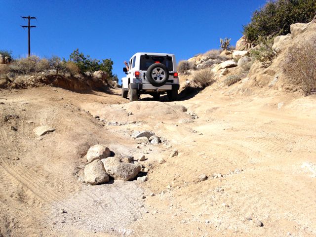
Almost as quickly as the trail had become rough, it smoothed out again. Past Angelina Springs cultural preserve, the rocks seemingly disappeared. Perhaps they had been pulverized into sand - that was our next challenge. Deep sands covered the route - Tom had to keep his speed up to keep from getting stuck, and that necessary speed meant a bit of skidding around some of the turns.
As we started the last climb toward Ranchita and Highway S22, however, the sandy spots lessened and we headed into ranching country. We passed the R2 ranch, nestled in cottonwood trees, glowing gold this afternoon.
We emerged from our excursion in Grapevine Canyon, found the pavement once again,and continued west to Dudley’s bakery in Santa Ysabel, another dozen miles down the road. A long way for a loaf of bread? Dudley’s is well known in this area, and our off-road detour just one of those things we love to do in Borrego.
Next stop is just down the road at The Springs at Borrego RV Resort..
See More Postcards